Amsterdam is a city that is both historic and progressive, elegant and bawdy. There are 17th century canals alongside trendy cannabis shops…and bicycles outnumber humans.
Even with everything to see, it is possible to get a good feel for the city in one day – and an Amsterdam walking tour is a fantastic way to do it!
Our site utilizes Affiliate Links. If you use them to make a purchase, we may earn a commission. For more information, read our Disclosure Policy.
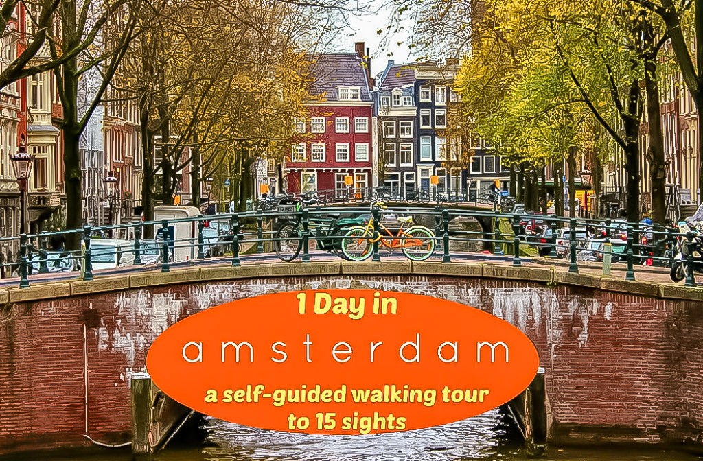
We designed our One Day in Amsterdam Self-Guided Walk to take you to the best sights. Plus, an Amsterdam Walking Tour Map is included!
About Our Amsterdam Walking Tour
Sightseeing in Amsterdam is best done on foot. To see the top sights, we will have to cover some ground, so expect the tour to take at least 2 hours.
Don’t fear, we created an easy-flowing route that is perfect for first-time visitors or those who have yet to discover all the prime places.
We highlight individual attractions, provide walking directions and include two Amsterdam Maps. One being interactive and the other is an Amsterdam PDF Map.
You will also find our Walking Tour Amsterdam Tips and more suggestions for things to do throughout the article.
Want this tour without the advertisements? You can buy it here for less than a cup of coffee!
One Day in Amsterdam, Netherlands

Planning what to see in Amsterdam is no easy task – especially if you are limited to one day. No need to worry. Whether you have 2 hours or 24, you can use our outlined Amsterdam walk.
The main route of our tour circles the city in a loop. We officially begin at Centraal Station, but you can start at any point.
To make the most of your self-guided tour – and not miss any attractions – we highlight nearby sights. These detours during your walking tour in Amsterdam are perfect for planning a 1-day itinerary.
What You Will Need for this Amsterdam Walk
Fortunately, you won’t need much to get started on this tour. We provide all of the information for where to walk in Amsterdam – you just have to follow along! However, we do have a few tips before you set off.
Connectivity
You can print our Amsterdam Sightseeing Map PDF, but a reliable signal is necessary for the map links that provide step-by-step navigation.
Back when our phones were locked, we used GlocalMe to stay connected abroad. Their eSIM data packages are priced competitively and the hot-spot allows up to 10 devices to be connected at once.
Amsterdam Walking Shoes
The city is fairly flat, but we still suggest wearing durable travel shoes. I like these trainers by New Balance and Kris prefers Merrell Trail Shoes.
Travel Camera
You can take in the beauty of the city while walking the Amsterdam canals and streets. In order to truly capture it all, we recommend using an actual camera.
We shoot with a Canon Rebel and a 18-135mm lens. It’s a great set-up and the bundle comes with loads of accessories, making it an excellent value camera for traveling.
Amsterdam Tourist Card
If visiting the museums and other top attractions in Amsterdam, consider purchasing a City Card. It includes entry into many of our recommended venues (except the Anne Frank Museum).
Plus, it provides free access to public transportation and a canal boat ride, which is a wonderful way to end your Amsterdam tour!
Self-Guided Free Walking Tour of Amsterdam
Okay, lace up your shoes and grab your camera – it’s time to go see Amsterdam! We will start off at…
#1 Amsterdam Central

MAP. Central Station was opened in 1889 and today 200,000 passengers pass through daily. The south-facing main entrance opens onto the most historic part of the city.
If you look to the southeast, you will see the towering Basilica of Saint Nicholas. The church was built in the late 1800s and is free to visit.

Before departing the area, find Cuyperspassage (map). This tunnel leads from the south side of the station to the north side – but the reason we recommend seeking it out is for its decor.
The interior is lined with and astounding 80,000 Delft Blue tiles. The famous Netherland tiles are a must-see, so we suggest ducking in on your Amsterdam sightseeing route.
Directions: From the front of Central Station, walk south and straight onto the west side of Damrak Street.
#2 Damrak

MAP. This is the main north-south route from Central Station to Dam Square. Once a busy waterway, the Damrak Canal was filled in to make a street in 1672.
The remaining small body of water that you pass by on the east side of the street was at one time a thriving harbor. Buildings were designed to open directly onto ships for quick transfer of goods.
Many boat tours now depart from here. We offer more information about canal cruises in Amsterdam at the end of the post.
Most buildings along Damrak were built in the 18th or 19th century – and more than 20 of them are designated as Royal Monuments. The large, brick Beurs van Berlage was once the stock exchange and is now a concert hall.
Directions: Stay on Damrak to the south end of Beurs van Berlage. On your right, you will see the Old Amsterdam Cheese Store (map), stop in for a sample!
After a few nibbles, use the next alley on your right – the elegant Beurspassage (map) – to cut across to Nieuwendijk.

Now turn right to the first store on your right, Van der Linde Ice Cream Shop (map). There will likely be a line, but it moves fast, so pop in for a scoop of Mr. Whippy Vanilla (cash only). It’s one of our favorite Things To Eat in Amsterdam!
#3 Nieuwendijk

MAP. Running parallel to Damrak is Nieuwendijk. This pedestrian-only shopping street is one of the most historic places to walk in Amsterdam.
The narrow, brick lane is home to more than 200 shops and nearly 100 of the structures are labeled as national heritage sites.
Directions: Walk south on Nieuwendijk as you make your way to…
#4 Dam Square

MAP. This square marks the historical center of Amsterdam. It is located at the original Amstel River Dam, which was built in 1270.
A top sightseeing stop on our Amsterdam city walk route, many notable buildings and monuments are situated here.
Make sure to set your eyes on the Royal Palace (map). It was constructed in 1655 as City Hall and converted to a royal residence in 1808. Today, it’s open to the public, but tickets are required.
Right next door is De Nieuwe Kerk – or New Church (map). Built in the 15th century, it has long been used for royal weddings and important ceremonies – but today it serves as an exhibition space. Admission required.
The National Monument pillar, which sits on the east side of the square (map), was built in 1956. The 70-foot-tall obelisk honors the victims of World War II.

Before leaving Dam Square, there are a couple of hidden gems that you might want to find.
If you like elevated perches, make your way to the Peek & Cloppenburg Department Store (map). The view over Dam Square from the top floor is wonderful (and free).
Another secret spot is De Drie Fleschjes – or Three Little Bottles (map). This bar is found by following the narrow passageway, Eggertstraat, around the east side of De Nieuwe Kerk.
The classic Amsterdam tavern is a jenever bar (a local Dutch gin) and the establishment dates to 1650.
Directions: From the WWII memorial on Dam Square, walk north on Warmoesstraat to Wijde Kerksteeg and turn right.
#5 De Oude Kerk (The Old Church)

MAP. This 800-year-old place of worship is Amsterdam’s oldest building; it was consecrated in the year 1306.
Built as a Catholic Church, it is now a Calvinist Dutch Reform Church, but the space is also used as an art gallery (and is free to visit with the City Card).

Not far from The Old Church is one of the city’s historically hidden spots: Museum Ons’ Lieve Heer op Solder – or Our Lord in the Attic Museum (map).
We believe it’s one of the most fascinating buildings in the city and well worth a peek if you have time. An entry ticket is required, but is included with the City Card.
Directions: Walk around the Old Church to the right, cross Oudekennissteeg bridge and continue to the next canal.
#6 Red Light District

MAP. The Red Light is an odd prostitution-as-a-tourist-attraction sight. During the day, most of the window boxes are vacant. At night, it is quite a different scene.
The Red Lights Secrets Museum and Erotic Museum are situated in the heart of the district and are practically next door neighbors. Both require a ticket and offer insight into this unique part of the city.

To truly get a better understanding of the area in full swing, join this Red Light District Private Tour at Night.
Directions: Walk north on Oudezijds Achterburgwal to Korte Stormsteeg, go right to Zeedijk and then right again.
#7 Amsterdam Chinatown

MAP. A plethora of Asian (not just Chinese) shops and restaurants line Zeedijk, the main street is what is commonly called Chinatown.
The He Hua Buddhist Temple, built in 2000, is a striking difference to the rest of the architecture found in Amsterdam Old Town.
Directions: Continue south to Nieuwmarkt Square and De Waag.
#8 De Waag

MAP. The Weigh House is Amsterdam’s oldest non-religious structure. Dating to the 15th century, it was once part of the city walls and served as an entryway.
Through the centuries, it has also been used as a guildhall, a museum, a fire station and a theater. Today, the building is listed as a national monument and houses an atmospheric restaurant.
Directions: Exit to the south on Sint Antoniesbreestraat. Cross the canal toward the Rembrandt House Museum (which is worth stopping in to see and is free with the City Card – map). Then, turn right on Zwanenburgwal.
#9 Waterlooplein Market

MAP. This outdoor market is one of the best in Amsterdam. It has more than 300 stalls selling second-hand clothing, antiques, tools, books and other trinkets.
It originated as a Jewish bazaar in 1893 and was revitalized as a general market in the 1960s. (Note that it is closed on Sundays.)
Directions: At the southeast end of the market, turn right on Waterlooplein Street and right again before the bridge and walk onto the waterfront.
#10 National Opera & Ballet

MAP. The National Opera and Ballet, nicknamed Stopera, fronts the Amstel River. The modern building, constructed in the 1980s, was met with many protests – thus the alternate name: Stop the Opera…or Stopera for short.
Many of Amsterdam’s iconic houseboats are moored along this scenic section of the Amstel. Pause for a moment and take it all in!
Directions: Walk just a few steps south from the Opera onto the decorative bridge.
#11 Blauwbrug (Blue Bridge)

MAP. The ornate Blauwbrug is named for an old wooden bridge that used to straddle the river on the same site.
The current one dates to 1883 and features sumptuous decorations. Despite not being painted royal blue, the original name stuck.
From this point, circle around for a 360-degree panorama of the city. The Opera, where you just came from, is directly north and the renowned Hermitage Amsterdam Museum – or H’ART – is to the southeast (map).
Directly south is the Magere Brug – or Skinny Bridge – which is a picturesque wooden drawbridge and one of our favorites (map).
Directions: Walk west on Amstelstraat to the lively Rembrandt Square.
#12 Rembrandtplein

MAP. Dating to the Middle Ages, this square was once an entry point through the city walls. Then, in the 17th century, it was occupied by the Butter Market – a place farmers sold their milk and eggs.
It only took on the current name in 1876, when a statue of Rembrandt – Amsterdam’s most famous painter – was placed here.
The Rembrandt statue is surrounded by a cast of characters from his most iconic painting, The Night Watch – which are fun for photo ops.
Although the area is best known for its nightlife, there are several top Amsterdam sights in the vicinity that are worth exploring.
Two that we recommend are the Willet-Holtuysen Museum (map) and Museum Van Loon (map), both of which are historically preserved canal houses (and are free with the City Card).
The Archives Museum (in the De Bazel Building) is also close by and offers excellent exhibits and free, clean toilets (map).
For a quick snack, pop into Eetsalon Van Dobben, a long-standing Amsterdam sandwich shop (map).
Directions: Walk west from Rembrandtplein on Reguliersbreestraat and continue to…
#13 Muntplein

MAP. This busy square is actually a bridge where six streets converge. The original Munt Tower (Munttoren) was build in the 1480s as part of the city fortifications.
After the original structure was devasted by fire, it was rebuilt in 1620 in its current architectural style and used to mint gold and silver coins. The tower has a 38-bell carillon and drum from 1668 that still work today!
Directions: Take just a few steps to the south to Singel and the beloved Flower Market.
#14 Bloemenmarkt

MAP. No ordinary flower market, the Bloemenmarkt is unique in that the stalls are floating on barges.
Established in 1862 to meet the growing demand for fresh flowers, the traders would arrive by boat from the countryside and dock along the Singel Canal.
Today, the shops are permanently moored – and are more like floating greenhouses.
 Here, you can find everything from seeds to fresh cuts to carved wooden tulips (which are popular souvenirs).
The floating marketplace is not to be missed; it is one of the most colorful (and fragrant) spots in the city!
Directions: Leisurely stroll the length of the market, continuing west to Koningsplein. Turn left and walk to Prinsengracht Canal.
#15 Amsterdam Canal Ring

MAP. The network of canals in Amsterdam date to the 17th century and are a UNESCO World Heritage Site. In our opinion, this stretch along Prinsengracht is the most exceptional.
Once an integral part of development and maritime trade, the land around the canals was purchased by wealthy residents. They built beautiful gabled houses, enhancing the overall appeal of the area.
Most homes were constructed on wooden foundations that are shifting. However, the ones that appear to be leaning over the street were purposely built that way to look bigger than they really were.
For this self-guided walk in Amsterdam, we are going to follow the canals along the west side of the city to the north.
However, if you are planning a one-day Amsterdam itinerary, this is the perfect time to detour south to Museumplein, where you will find the highly acclaimed Rijksmuseum (map) and Van Gogh Museum (map).
Other nearby sights are the spacious Vondelpark (map) and the atmospheric De Pijp district (map).
If you make this detour, just be sure to circle back to the canals to complete the walk.
Directions: Walk north on Prinsengracht to the…
#16 Nine Streets Amsterdam (Negen Straatjes)

MAP. This tiny neighborhood is a 3-by-3 grid of picturesque lanes lined with boutique stores, high-end specialty shops and chic cafes. Originally occupied by tanners, many of the streets are named after animals.
Combined, they are one of the most picturesque places to see in Amsterdam. Wander freely or use these directions for a quick 12-minute walk.
Quite a few lesser-known attractions are in the vicinity of The 9 Streets, which you might want to seek out before moving on.
The secret Begijnhof Garden, which conceals two hidden churches, is accessed via an inconspicuous arched doorway (map).
Not far away is the Amsterdam Museum. While a ticket is required, the Civic Guards Gallery exhibit is free (map).
The Houseboat Museum (map) sits on the west side of Prinsengracht Canal at Berensluis Street. Although quite small, it’s interesting to see how the inside is decorated!
Directions: After touring the 9 Streets and any nearby sights, continue walking north on Prinsengracht to…
#17 Westerkerk

MAP. Built between 1620 and 1631, this was the largest Protestant church in the world at the time. It features the tallest religious tower in Amsterdam, rising to a height of 279 feet.
Famous Dutch artist Rembrandt van Rijn is buried here and, in 1966, Queen Beatrix chose Westerkerk for her wedding ceremony. It’s free to go inside and they have free organ lunchtime recitals.
Directions: Take a very short stroll north along the canal to…
#18 Anne Frank House

MAP. Number 263 Prinsengracht is an ordinary Amsterdam house that has an extraordinary history. It is the place where Anne Frank and her family hid from the Nazis during World War II.
Now a museum, visitors are permitted to enter the home and the hiding spaces. Tickets should be booked far in advance; it is not included with the City Card.
If tickets are unavailable during your trip, consider joining a private tour – like this one – or a group Anne Frank Tour to learn more about her life in isolation.
Directions: Walk north past the Anne Frank House to the first bridge, Leliegracht, and cross west into the…
#19 Jordaan Neighborhood

MAP. The working class settled this enclave in the 17th century and they attracted many people with political ideals.
In the 1970s, gentrification took over, bringing young professionals, well-to-do families and trendy cafes, bars, galleries and specialty shops.
Today, the inviting district is characterized by elegant houses, many of which hide hofjes (inner courtyards) and feature Gable Stones.
These stone plaques displayed on the front of the homes were first used in the 16th century. They were a means of identifying the inhabitants by depicting the owner’s profession or family name.
We believe it’s best to simply wander through Jordaan, turning down whichever quaint street looks most appealing.
However, this zigzagging route along Tweede Egelantiersdwarsstraat, Westerstraat, Noorderkerkstraat and Brouwersgracht offers a nice walk in Jordaan (map).

There are limited ‘sights’ in Jordaan – with the exception of The Tulip Museum (map), which we thought was surprisingly interesting.
The often humorous displays detail the history of tulips in the Netherlands – as well as the hysteria of the Golden Age Tulipmania.
Another fun way to experience the neighborhood is on a Food Tour of Jordaan. That said, there are heaps of foodie stops nearby that you can explore on your own.
For classic Amsterdam fries, go to Heertje Friet (map); for a savory meal of Dutch-style pancakes, the Pancake Bakery is nearby (map). For a Dutch beer, head to Proeflokaal Arendsnest (map).
Directions: When you are finished touring Jordaan, make your way to the Brouwersgracht canal. Named in the late 1500s for the breweries that occupied the canal houses, it’s considered by many to be one of the most beautiful Amsterdam canals. From here, it’s an easy walk back to Centraal Station (map).
That concludes our Amsterdam Walking Tour. Keep scrolling for maps, more things to do and our honest travel advice!

Amsterdam Walking Tour Maps
Our map of the Amsterdam City Center is interactive; click on any of the markers for more information and zoom in or out for a better view.
The blue numbers are the primary sights (#1-19); the orange pin-drops indicate any mentioned nearby attractions.

Amsterdam Self-Guided Walking Tour Printable Map
To print our Amsterdam Walking Route Map below, click on it and then right click outside of the image and select print!

More Amsterdam Sightseeing Options

Too much walking? No problem! There are alternate choices that are much easier on your feet.
Amsterdam Bus and Boat Tour
The classic Hop-On-Hop-Off Bus moves tourists effortlessly through the streets to prime attractions. The ticket is good for 24 hours and also includes a boat route!
Bike Rental
A popular alternative to walking is to rent a bike! You can discover the top places to visit in Amsterdam on two wheels at your own pace (or join a tour).
Amsterdam Canal Boat
Want to cruise the canal? Of course you do! There are plenty of options, so have a peek at these sightseeing cruises to find one that fits your style.
Best Amsterdam Day Trips
Have enough time for an excursion? Consider taking a day trip to see the Famous Dutch Windmills, the iconic Tulip Fields, lovely Haarlem or even over to fairytale Bruges, Belgium!
Amsterdam Travel Advice

Amsterdam is a fascinating city and there is so much to explore here! You can create your complete trip plan with our Amsterdam Itinerary – but for now we have a few essential tips to share.
Planning Your Amsterdam Trip
There is a lot that goes into planning a trip to Amsterdam – from what to see to things to eat to where to stay.
Get (and stay) organized for your vacation to Amsterdam by utilizing our Trip Planning Printables!

Watch Out for Bikes in Amsterdam

Bicycles are everywhere. As fans of pedal power, we were impressed with so many people using bikes as their method of transportation.
We found it amazing how effortlessly they moved about, even with the extra encumbrance of hauling groceries, musical instruments and multiple children. Visitors, however, need to be aware!
What To Eat and Drink in Amsterdam
Although we were hesitant at first, we absolutely love the food in the Netherlands! Read our article on Dutch Cuisine, which includes everything from cheese to apple pie.
Having a locally brewed Heineken is an essential Amsterdam experience. The distinctive red star logo is plastered throughout the city and it’s sold just about everywhere.
That said, don’t miss out on the unique and creative local beers. In fact, we have a complete guide to the Top Amsterdam Craft Beer Bars!
Where To Stay in Amsterdam
Staying in Amsterdam is expensive – so before you book your accommodations, read our guide for Finding Cheap Hotels.
For an Amsterdam layover hotel, Ibis Budget Amsterdam Airport is just a short walk to the bus station where you can catch a ride into the city center.
When we were in Amsterdam for Christmas, we stayed at the stylish Volkshotel near the hip De Pijp District. Key features of the property were the creative rooms, co-working space and rooftop hot tubs!
For those who prefer staying closer to the city, there are many choices as well. We suggest checking out Park Mansion Centre Hotel or The Toren!
Amsterdam Travel Insurance
Trip insurance may help cover costs associated with cancelled flights, lost luggage or when travelers become ill or get injured.
If you haven’t already obtained coverage for your European Vacation, consider traveling protected with World Nomads.
Start planning your trip to the Netherlands! Search for the lowest airfares, the best accommodations and fun things to do…then start packing! Want additional advice? Head over to our Travel Planning Page and for country-specific information, take a look at our Travel Guides Page!

Pin it! See all of our travel pins on our JetSetting Fools Pinterest Board.
