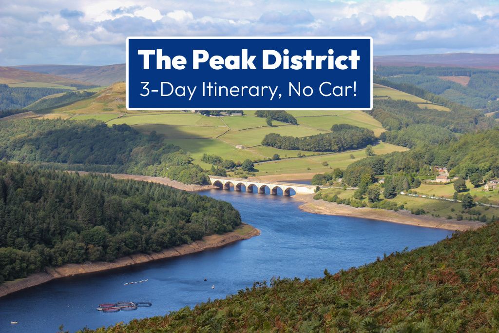
Are you planning a trip to the Peak District without a car? Our 3-day itinerary features moderate yet magnificent hikes, tips on how to get to the trailheads and advice on where to stay and what to eat!
As a general rule, we don’t drive in the UK – and because of that, we almost skipped going to Peak District National Park.
Our site utilizes Affiliate Links. If you use them to make a purchase, we may earn a commission. For more information, read our Disclosure Policy.
The landscapes are rugged and remote. The heather-covered moors, rocky escarpments, open pastures and rolling hills all feel pretty far-flung.
But here’s the secret: The region is easily accessible by public transport. In fact, some of the very best hikes in the Peak District can be reached by train and we are showcasing them in our 3-day itinerary!
Car-Free Peak District Itinerary: At a Glance
- Day 1: The Great Ridge Hike ~ 6.5 miles, moderate, point-to-point, 5-6 hours.
- Day 2: Hike to Stanage Edge (or Bamford Edge) ~ 6.5 miles, easy to moderate, loop, 4-5 hours.
- Day 3: Padley Gorge to Hathersage Moor ~ 5 miles, easy to moderate, loop, 4-5 hours.
Where To Stay
The Peak District is nestled between two major cities: Sheffield and Manchester. Although either could make a good base, for this trip, we recommend staying in Sheffield City Center.
The train station is conveniently located right in the heart of the city – along with fun restaurants, pubs and shops. Later, we share options for specific places to stay.
Good To Know
Each day of our trip plan features a fabulous hike within the northern, Dark Peak Area of the park.
The trails on this itinerary are all accessible via the Hope Valley Line. More details about traveling by train below.
For the evenings, we will also share our favorite local spots for a bite to eat and a post-hike pint!
Peak District Itinerary for 3 Days

There’s a lot to see and do in this region of England – so lace up your walking shoes and let’s get going!
DAY 1: Classic Peak District Hike

Kick off your trip on one of the most classic trails in the park: The Great Ridge. Then, end your day at a local brewery.
Morning/Afternoon

A must-do Peak District trail, The Great Ridge Trek is a popular point-to-point hike featuring amazing viewpoints, epic landscapes and an easy-to-follow path. Watch our Highlights Reel.
Distance: 6.5 miles | Difficulty: Moderate | Time: 5-6 hours
Getting There: The hike begins at Edale Train Station, which is a 30-minute ride from Sheffield.
Route: Edale, Mam Tor, Hollins Cross, Back Tor, Lose Hill, Hope. MAP. For walking directions, we used this article.
The scenery on this hike is simply outstanding as the views stretch across both Edale and Hope valleys. The high point – quite literally – is Mam Tor…and it’s the first summit you tackle.
Known as Mother Hill or Shivering Mountain, it reaches a height of 1700 feet. It was once the site of a fort during the Late Bronze Age and Early Iron Age.

From Mam Tor, follow the well-marked path to the top of both Back Tor and Lose Hill. The inclined trek can be a bit challenging, but the views are worth it!
After Lose Hill, it’s all downhill toward Hope…which took a bit longer than we had anticipated, but at least we had the company of sheep!
Top Tip: Before setting off on your hike, pop into The Penny Pot Café in Edale for take-away scones or sandwiches. (They also have toilets for customers and free maps.)
Evening

If you’re up for a post-hike pint, stop at Sheffield Tap; it’s actually inside the train station!
The pub replicates the Edwardian era of the early 1900s. The beer is fresh with loads of local cask and keg options, many from the on-site Tapped Brew Co.
Next, go to Triple Point Brewery for more suds straight from the source. Both the Cryo and the Reef are refreshing after a long day of hiking.
Stay for dinner with tasty options from Twisted Burger. It’s not all beef – they have chicken and vegan burgers, too. Also, check out their weekday happy hour specials and 2-for-1 burger deals!
Day 2: Peak District Hike to an ‘Edge’

Today, set off on a circular route to one of the Peak District’s famous rocky escarpments: Stanage Edge or Bamford Edge. Or, if you are feeling motivated, combine them into one long point-to-point hike!
Morning/Afternoon

First things first: Decide which route you want to take. We hiked both separately and don’t regret it. They each have stunning views and are fairly moderate walks.
If we were pressed on time, we would have considered combining them, but only on a gorgeous day with dry conditions and a proper trail map. So, let’s talk details to help you better decide.
Option 1: Hathersage to Stanage Edge Loop

Popular with both hikers and climbers, Stanage Edge – or Stone Edge – is one of the park’s prominent gritstone escarpments.
The panoramic views overlook Hope Valley, including iconic landmarks, like Mam Tor and Kinder Scout. Watch this Highlights Reel of our hike.
Distance: 6.5 miles | Difficulty: Easy to Moderate | Time: 4-5 hours
Getting There: The hike begins and ends at Hathersage Train Station. The trip from Sheffield takes approximately 17 minutes.
Route: Hathersage Station, Hathersage Village, Stanage Edge, Carhead Rocks, Hathersage Station. For detailed directions, we used this post.
From beginning to end, we loved every step of this hike! The trail was easy to follow and the views were dazzling. Plus, by hiking clockwise, the incline was gradual and we breezed right to the summit.

The cliff’s edge stretches for more than a mile and the broad, solid rocks allow you to take in the panorama from multiple viewpoints (but take care close to the edge, especially when it’s windy).
We lingered at the clifftop – and even ate lunch – before finding the least punishing route down toward the small parking lot.
From there, we walked up to Carhead Rocks – like a mini-Stanage Edge – and it was here that we left the crowds behind.
The rest of the hike back to Hathersage was highlighted by pastures, a vineyard and tree-lined lanes.
Fun Fact: Stanage Edge was a famous filming location for Pride and Prejudice in 2005; Elizabeth Bennet (played by Kiera Knightly) stands there daydreaming.
Option 2: Bamford Edge Walk to Ladybower Reservoir

A well-trodden path with one of the most recognizable views in PDNP, Bamford Edge is a fantastic hike with a variety of landscapes. Watch the Highlights Reel of our hike.
Distance: 5 miles | Difficulty: Easy to Moderate | Time: 3-4 hours
Getting There: The hike begins and ends at Bamford Train Station. The ride takes about 21 minutes from Sheffield.
Route: Bamford Station, Bamford Edge, Ladybower Reservoir Dam, Bamford Mill, Bamford Station. For turn-by-turn directions, we used this article.
We almost scratched this hike from our list, but so glad we didn’t! Although it features some inclines and questionable stiles – and there was a relentless wind at the top – we had a fabulous time on this trail.

Straight away, we opted for the longer, sloping route through pastures to get from the station to the Bamford Edge Trailhead. (Follow the ‘alternative’ directions under #17 on the linked post above.)
Once at the top of the cliffs, we marveled at the valley, with each further step revealing a slightly different angle.
However, it was the viewpoint over Ladybower Reservoir and the arched Ashopton Viaduct that was truly the pinnacle of the hike.
From there, the path winds down through a bright green, moss-covered forest along a creek. Once we crossed Ladybower Dam, it was an easy walk along a clearly defined path back to the station.
Top Tip: If you’re really feeling energized, consider adding Win Hill to your hike after you cross the dam!
Option 3: Bamford Edge to Stanage Edge Point-to-Point

Distance: 10 miles | Difficulty: Moderate | Time: 5-7 hours
Getting There: The hike begins at Bamford Train Station and ends at Hathersage Train Station.
Route: Bamford Station, Bamford Edge, Stanage Edge, Hathersage Station.
We didn’t do this hike – one of the reasons being that we couldn’t find proper route directions anywhere online.
That said, we talked to many hikers that said it is possible. If we were feeling a bit more adventurous, we would have tried it.
Evening

Whichever route you choose, be back in Sheffield for a fun night out in one of the city’s best districts: Kelham Island.
Once filled with powerhouse factories of the steel industry, the area is now awash with independent eateries and microbreweries.
Home to classic cask beer haunts, like The Fat Cat and Kelham Island Tavern, we bar-hopped our way through the enclave.
Top picks for a local pint of keg brew are Hymn to Ninkasi, Factory Floor (featuring fresh tank beer from Neepsend Brewery) and SALT.

Cutlery Works is a fun spot with tons of food options. We devoured a Neapolitan wood-fired pizza from Leopard Pie and their signature Honey Butter Ring that they describe as ‘a love child of a doughnut and garlic bread.’
Alternatively, sit down for a pub meal with a waterfront perch at Riverside Kelham. We dove into burgers, but they also feature fish and chips, sausage and mash and savory hand-made pies.
DAY 3: Forest to Field Hike in the Peak District

On the last day of your Peak District hiking trip, complete a relatively easy jaunt through a gorgeous gorge, then continue through a stunning heather-covered moor up to unique rock formations.
Morning/Afternoon

The Padley Gorge to Hathersage Moor hike is a circular trail that traverses dense forest and open moorland with outstanding views along the way. Watch the Highlights Reel of our hike.
Distance: 5 miles | Difficulty: Easy to Moderate | Time: 4-5 hours
Getting There: The hike begins and ends at Grindleford Train Station. The journey from Sheffield takes 14 minutes.
Route: Grindleford Station, Padley Gorge, Hathersage Moor, Grindleford Station. For directions, we used this guide…but some unclear wording got us lost multiple times.
In the end, we ended up creating our own trek (which was similar, but not exactly the same). So, this hike ended up being kind of a struggle.
With a nagging injury, fierce winds, an inability to keep to the route and a wrong turn right from the start, our day was kind of doomed. (But the scenery was impressive!)

Once we finally found our way to the west side of the gorge and the trailhead, we trekked through the forest with the constant gurgle of the Burbage Brook as our soundtrack.
When we emerged from the woodland, we got a bit turned around again and ended up at Owler Tor. Rather than retracing our steps, we just kept walking north.
We crossed the road (A6187) near the Surprise View Car Park – then continued north through the brush and heather up to Over Owler Tor and on to the magnificent Mother Cap rock formation.

The sweeping views were exceptional, but the wind was brutal. We leaned into the howling gusts and headed north and then hooked around to the east to reunite with Burbage Brook just south of Toad’s Mouth.
Once we were back in the gorge and walking south, we crossed over to the east side of the brook (there are multiple bridges) and it was fairly easy going back to the station.
Top Tip: If you decide to follow the post we link to, it’s a good idea to plot it out on a map first. During our hike, a sign was missing, there was a mistake in the directions and we ended up getting really frustrated.
Evening

Tonight, grab a pint and a seat outdoors at one of the city’s top multitaps – like Hop Hideout or The Old Shoe.
Both establishments are dedicated to local craft beer and are the perfect place to post up after a long day of hiking.
Then for dinner, head to Cambridge Street Collective. Claiming to be Europe’s largest purpose-built food hall, it has three levels, heaps of international eats, an open-air rooftop and a full calendar of events!
Foodie Tip: Would you rather dine with table service? Grazie – a Southern Italian restaurant known for its authentic dishes – seems to be a favorite!

Travel Tips for your Peak District Trip

Now that we’ve outlined our top hikes to do by train and fun places to eat and drink, let’s talk logistics (aka the boring stuff).
How To Get There
Sheffield is well-connected by train. EMR (East Midlands Railway) services depart London from St. Pancras and reach Sheffield Station in about 2 hours. It’s best to buy tickets in advance for the cheapest prices.
Accommodations
When we started looking for places to stay in Sheffield, we had two requirements: Location and Affordability.
We wanted to be within a 15-minute walk of the train station, restaurants and bars…and we didn’t want to spend a lot as we were just planning on sleeping there.
We ended up booking this studio apartment. It had a small kitchen, which was great for making breakfasts and packable lunches – and the price was less than $100 per night.
That said, if we were looking for a hotel, we would have likely booked a cheap room at either EasyHotel (for a bare-bones, basic space) or Leopold Hotel (which is quite a bit nicer, but still affordable).
Getting Around Peak District Without a Car

With the help of trains and buses, it’s actually easy to get around the Peak District car-free!
By Train: Hope Valley Line
This route connects Sheffield and Manchester and runs right through Peak District National Park, making stops at or near trailheads along the way.
From Sheffield, the key stops for hikes are Grindleford (Padley Gorge Walk), Hathersage (Stanage Edge Hike), Bamford (Bamford Edge Walk), Hope (Great Ridge Hike) and Edale (Mam Tor/Great Ridge).
During our early September trip, services ran hourly. The 10:14 departure was ideal for our hiking expeditions. (Schedules do change though, so check before planning your day out!)
The Hope Valley Line is run by Northern Railway and we bought Off-Peak Day Return Tickets We also used our Two Together Rail Card to get discounted prices.
Good To Know: While the stations at Edale and Grindleford are near the trailheads, in Hope and Hathersage they’re about a 15 minute walk away.
By Bus: Routes from Sheffield
Public buses can be used to get around PDNP, too. Although we stuck to train travel, there are several services from Sheffield to areas not served by rail.
- Peak Line 218: Chatsworth House and walks near Baslow and Edensor
- Bus 271/272: Hope Valley, including Castleton and Cave Dale trails
- Bus 65: Longshaw Estate and Monsal Trail
- Bus 257: Win Hill walks
Additionally, the Peak Sightseer is an open-air tour bus run by Stagecoach. It has two routes that wind through the park.
What To Bring on Peak District Day Hikes

Based on our adventures, we have a few bits of advice about what you will need for day hikes at PDNP.
Durable Shoes
I usually hike in my everyday trainers, but the terrain here was a bit too rough, boggy and steep. I ended up buying a new pair of hiking shoes after our first trek (which I don’t recommend, but it was better than slipping all over the trail).
Windbreaker
With high open moorlands, exposed gritstone edges and elevated summits, the wind can really howl. I wore my rain jacket/windbreaker on every single hike.
Camera & Binoculars
The stunning landscapes are what enticed us here, so we definitely brought our Canon Rebel and a 18-135mm lens. We also had binoculars, which were great for surveying the scene.
Day Pack
We both carried a small backpack on these hikes. They were just the right size for water (1 liter each, there is no place to refill on the trails), extra layers, snacks and a packed lunch.
Peak District Map
We didn’t end up buying a map for Peak District hikes, but wished we’d had! It could have helped immensely when we were out on the trails.
Portable Charger
You may need a mid-hike boost for your phone – so be sure to bring a portable charger. We go everywhere with this one.
Tips for Hiking Peak District Trails

Here’s a few final things to know before you set off hiking the Peak District!
Trails and Paths
- There are thousands of mapped routes in the park – and many intersect.
- Most paths are not marked, which makes it easy to get confused.
- You likely won’t be the sole hiker; ask others if you are unsure!
Online Routes and Directions
- We used a combination of written directions and online maps – but we should have purchased an actual map.
- We did maintain a cell signal during our hikes, so we could use Google Maps. (Although, many of the trails weren’t on it!)
- We recommend thoroughly reading directions and plotting your walk on a map before you set out.
Start planning your trip to the UK! Search for the lowest airfares, the best accommodations and fun things to do…then start packing! Want additional advice? Head over to our Travel Planning Page and for country-specific information, take a look at our Travel Guides Page!
More Top UK Adventures & Destinations
- Walking Seven Sisters from Eastbourne
- Cotswolds Without a Car
- Hiking the West Highland Way
- Coastal Walks in Aberdeen
- London Day Trips by Train

Pin it! See all of our travel pins on our JetSetting Fools Pinterest Board.
