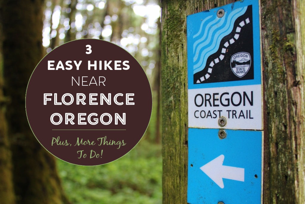
Hiking is one of the best things to do on the Oregon coast! Miles of trails stretch out along the coastline – and we discovered a few of the top hikes near Florence, Oregon.
Both state and national parks abound in the area around Florence, providing abundant access to nature via trails and lookout points. Lace up your shoes and head out on our three recommended Oregon Coast hikes!
Our site utilizes Affiliate Links. If you use them to make a purchase, we may earn a commission. For more information, read our Disclosure Policy.
In addition to our featured Florence, Oregon hikes, we also offer recommendations for what gear you will need. We also provide top tips for things to do and where to stay in Florence at the end of the article.
Best Hikes Near Florence, Oregon

Trekkers who go hiking near Florence, Oregon won’t be disappointed; the scenery is simply stunning.
The area features massive sand dunes, mossy forests, babbling streams, sandy beaches and picture-perfect lighthouses. All of which are accessible via our recommended Florence, Oregon hiking trails.
Visitors who want to see the varied landscapes can follow in our footsteps to three easy hikes near Florence, Oregon. Hikers will discover hidden beaches, dense forests, dramatic cliffs and flowing waterfalls.
#1 Sweet Creek Falls Trail

Sweet Creek Falls is one of the best hikes near Florence, Oregon that is off the coast. Rather than following the coastline, this trail leads inland to some of the best waterfalls near Florence, Oregon.
About the Sweet Creek Waterfalls Hike in Oregon

Within moments of beginning the hike at the Homestead Trailhead, we could already hear the gurgling water of Sweet Creek rushing over rocks towards the Siuslaw River.
Under towering evergreens, we quickly met up with the creek – a series of small, tumbling waterfalls – and followed the water’s edge.
The easy trail, a combination of dirt and raised walkways, stretches 2.2 miles and ends at the cascading Sweet Creek Falls.
Along the Sweet Creek Trail Oregon trek, side paths lead down to the water where hikers are welcome to cool their feet or take even a swim!
How To Get to Sweet Creek Falls

MAP. From Florence, take Highway 126 to Mapleton; turn right to cross the bridge (staying on 126); take the first right onto Sweet Creek Road.
Follow Sweet Creek Road 11 miles to the Homestead Trailhead. The Sweet Creek Falls Trail is part of the Siuslaw National Forest and there is no fee to park, as well as restrooms.
Click here for a trail map and here for more information.

#2 Tahkenitch Creek Trail

The Tahkenitch Creek Trail features many unique aspects of the diverse Oregon Coast – from wooded paths to sandy dunes. That diversity makes it one of the best hikes near Florence, Oregon.
The trail consists of two loops and a long stretching path that leads south to a wide, flat beach (where Snowy Plover birds nest during the summer months).
There are options to detour onto other trails; the Tahkenitch Dunes Trail to the east over the top of the dunes or to the south to Threemile Lake.
About Tahkenitch Hikes on the Oregon Coast

We started the Tahkentich Creek hike without a specific route in mind – but the beach was our destination.
As we headed south toward the beach, we stayed on the east side of the loops, but then took the western side of the loops on our return trip. The total distance of our hike was about 5 miles.

Throughout this Oregon coastal hike, the path changed from shaded dirt trails through forest to sandy paths that followed the edge of the dunes.
We found it somewhat challenging to hike through the soft sand (it would have been easier if we had hiking poles), but the hike itself was fairly easy with little elevation change.
How To Get to Tahkenitch Creek Trailhead

MAP. The Tahkenitch Creek Trailhead is about 13 miles south of Florence on the west side of Highway 101. The parking lot is well marked with signs – and a Recreation Pass is required.
The Day Use permit costs $5 and can be purchased online. Click here for more trail information (including pass info!).
Note: There is no Fee Box at the Tahkenitch Creek Trailhead, but there is one just about a mile south at the Tahkenitch Campground and Tahkenitch Dunes Trailhead. (Remember to bring a pen and $5 cash or check for payment to complete the form!)
Pro Tip: The popular Oregon Dunes Loop Trail is just north of Tahkenitch Creek Trail. The trail is rated as a moderate hike.

#3 Heceta Head Trails

Heceta Head, home to the famous Heceta Lighthouse and Hobbit Beach, boast absolutely amazing trails.
In fact, the area is home to multiple of our favorite hikes in Florence, Oregon, including the Hobbit, Lighthouse, Valley and China Creek trails.
Each trail can be completed as an out-and-back…or the incredible Florence, OR hikes can be combined into one longer trail. These four Oregon nature walks can be accessed by three parking lots.
To help you plan your route at Heceta Head, we detail each of these Florence, Oregon hiking trails below and provide tips on how to combine the trails.
We also include a helpful Oregon Coast hiking trail map of Heceta Head hikes as well.
Hobbit Trail Oregon (Option A)

The Hobbit Trail is one of the easiest hiking trails near Florence, Oregon – and also one of the most popular.
The trail begins along Oregon Coastal Highway 101 and winds through the forest down to Hobbit Beach, Oregon.
About the Hobbit Trail

The blink-and-you’ll-miss-it Hobbit Beach Trailhead is located on the west side of Highway 101. Once on the Oregon Coast Hobbit Trail, we were enveloped in a surreal enchanted-like forest.
Following the path to the right, we were surrounded by the twisted, moss-covered trees that line the narrow path.
Sunlight filtered through the high canopy along the Oregon Hobbit Trail, illuminating the moss and making it seem as if we were looking through a green-tinted lens.
The zigzagging .5-mile path descends quickly and cuts through a natural passageway that immediately opens onto the wide, secluded Hobbit Beach.
How To Get to Hobbit Trail Oregon

MAP. The Hobbit Trail in Oregon is about a half-hour drive north of Florence. From Florence, take Highway 101 past the Sea Lion Cave and Heceta Head Lighthouse to Mile Marker 177.
After passing the Lighthouse and the hairpin turn, begin slowing down as the small Hobbit Trail parking area comes up quickly on your right (east) side of HWY 101.
When the road straightens out, you are almost to the parking lot where you will access the Hobbit Trail trailhead.
Use caution when crossing the highway and find the marked Hobbit trailhead slightly to the north. No fee to park; no restrooms. The Hobbit Trail is part of the Carl G. Washburne Memorial State Park.
Click here for more information (or scroll to bottom for our Hobbit Trail map).
Heceta Head Trail (Option B)

Starting at the same trailhead for Hobbit Beach, hikers can follow the trail to the left, south toward Heceta Head Lighthouse.
Significantly more challenging than Hobbit Trail, we think it is well worth the effort and one of the best hikes in Oregon!
About the Heceta Head Trail

The 1.5-mile trail dips into a gorge then rises over two hills before descending to the famed Heceta Head Lighthouse.
While hiking through the gorge, we had open views of the surrounding forest and the sound of the cars on the highway rapidly dissipated.
As we crested the hill, the forest grew dark and dense, most of the sunlight blocked by the thick, wind-carved foliage.
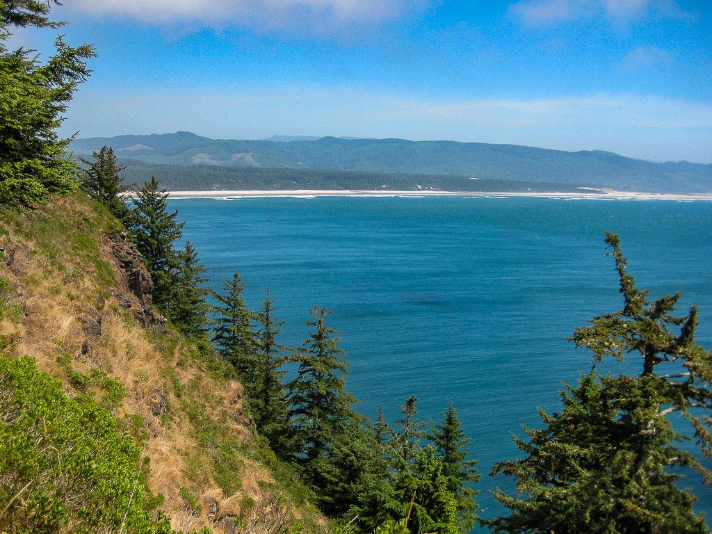
Lookout points offer wonderful glimpses down the rugged landscapes, which is why it ranks as one of the best hikes on the Oregon Coast.
We highly recommend making the short detours to look out at the ocean below. On the final approach to Heceta Head, the elevated path gives a extraordinary bird’s eye view of the lighthouse.
Volunteers give free lighthouse tours – typically at 11:00am and 3:00pm – which allowed us time to rest before making the return Heceta Head trek back to the car!
How To Get to Heceta Head Trailhead

The best way to access the Heceta Head hiking trail is to use the same parking lot listed above for the Hobbit Trail near Florence, Oregon.
Alternatively, visitors can park at the lighthouse, which we provide more information about in a minute. Click here for more information (scroll to bottom for map).
Valley Trail and China Creek Loop (Option C)

The Valley trailhead is located on the south end of the parking lot for the Hobbit and Lighthouse trails.
While most visitors are eager to embark on hikes to the beach or the lighthouse, the Valley Trail goes relatively unnoticed.
About Valley Trail and China Creek Loop
We also were so enamored with the Lighthouse and Hobbit Trail that we put off hiking the Valley Trail and the connecting China Creek Loop for way too long.
In hindsight, it is a shame, because these easy hikes are absolutely gorgeous – and, in our opinion, combine as some of the best hikes near Florence, Oregon.
The Valley Trail slowly descends into the forest passing by streams, ponds and meadows. After about 1 mile, the China Creek Loop breaks off to the right/east (it is well marked with a signpost).
Hikers can complete the half-mile loop and then retrace their steps to the parking lot via the Valley Trail.
How To Get to Valley (and China Creek) Trailhead
To access these easy hikes in Oregon, use the same parking lot as listed above for the Hobbit Trail in Florence, OR.
Alternatively, hikers can use the Carl G. Washburne Memorial Park Day Use parking lot (north of the Hobbit Trail lot, on the west side of the 101 – MAP); then complete the hike in reverse from our notated instructions.
Combine These Florence, Oregon Hiking Trails (Option D)

While each of the above hiking trails in Oregon are fabulous on their own, we think combining them is even better.
Those who want to embark on a longer trek can combine the three Oregon Coast hikes into one adventure!
About Combining Hiking Trails on the Oregon Coast
We believe the best way to combine these easy hikes is by starting on the Valley Trail. You can decide to include the China Creek Loop or bypass it (but we vote for including it!).
Either way, complete the Valley Trail to the Carl G Washburne Campsite. There, cross Highway 101 (the road does get busy, so be patient and wait for a break in traffic) to the Carl G Washburne Day Use parking area.
Walk straight onto a path that leads into a twisted grove of trees. At the end of the short trail are free restrooms – and the trail next to them on the left leads down to the beach (marked on the beach by a large 92 sign).
Walk south on the hard packed sand beach for about 1.5 miles toward Heceta Headland. Find the yellow 93 sign, which marks the trailhead for the Hobbit Trail. Make the inclined hike through the captivating nature and back to the 101 and the parking lot.
This route – our favored way to make the trek – is about 4 miles. We recommend hikers complete the hike counterclockwise, especially if the northerly winds are high on Hobbit Beach, because this way the wind will be at your back!
Hikers eager for more Oregon Coast exploring can continue their trek by completing the Heceta Head Trail to the Heceta Lighthouse from the end of the Hobbit Trail. This route will add another 3 miles to your hike.
Pro Tip: Because this route includes walking on the beach, we recommend looking at the tide charts prior to beginning the hike.
Alternate Heceta Hikes (Option E)
Rather than beginning at the Hobbit Beach Trailhead, trekkers will begin this hike along the Oregon Coast at the main entrance to the Heceta Lighthouse. (Parking information below.) This route is about 7.5 miles.
About the Combined Trails for Hiking near Florence, Oregon
From the Heceta Lighthouse Trailhead, follow the wide, inclined path toward the lighthouse. Along this popular portion of the trail, there are phenomenal views of Cape Cove.
Just before arriving at the lighthouse, follow the ascending stairs into the forest; this marks the beginning of the Heceta Head Trail.
Follow the path until it reaches the highway; carefully cross the 101 and join the Valley Trail. Take the China Creek Loop and continue to the Carl G. Washburne camp grounds.
Cross HWY 101 again toward the beach and walk south on the beach to the Hobbit Trail (marked 93). At the end of the Hobbit Trek, follow the Heceta Head Trail back to the lighthouse.
Before leaving, be sure to check out Cape Cove Beach. Peer into the narrow cove just below the lighthouse and look for Harbor Seals!
Top Tip: If your visit coincides with low tide, be sure to check the tidal pools for bright orange and purple starfish!
Shorter Oregon Coast Hiking Trails from Heceta Head Lighthouse (Option F)

If a 8-mile hike doesn’t interest you, consider combining three trails – Lighthouse, Heceta Head and Hobbit Trail – for a 5-mile out-and-back hike.
About the Combined Hikes on Oregon Coast
Start on the Lighthouse Trail, hook up with the Heceta Head Trail and merge onto the Hobbit Trail Oregon Coast path and complete the final half mile down to Hobbit Beach.
How To Get to Heceta Lighthouse Trailhead
MAP. From Florence, Oregon, follow the signs to the Heceta Lighthouse past the Sea Lions Cave.
When traveling north on the 101, Lighthouse visitors cross Cape Creek Bridge and make a right-hand turn onto Cape Creek Road, which curves back to the coast underneath the bridge.
The parking lot, right on Cape Cove Beach, is a Day Use lot that requires a fee ($5, paid via credit card at the machine).
If driving south on the 101 (coming from the north), there is a right turn to Heceta Lighthouse that is well marked.

Heceta Head Hikes Map
Our Heceta Head and Hobbit Trail Oregon Map provides a rough guideline to the intertwining Florence hiking trails.

More Hiking in Oregon
We have highlighted the best hiking in Florence, Oregon – but there is abundant nature in the region.
There are numerous beautiful hikes in Oregon – on the coast and inland – that are just a short drive from Florence!
Coastal Hikes North of Florence, Oregon

The coastline from Florence north to Cannon Beach is one of the most beautiful stretches of nature in the United States.
We highly recommend driving the route – and give specific details for things to see in our article, Driving the Oregon Coast.
In addition to the stunning scenic landscapes, the region is also home to some of the best hiking trails in Oregon.
Cape Lookout
We think one of the best Oregon Coast hikes located north of Florence is at Cape Lookout State Park. More specifically, the Cape Lookout Trail ranks as one of the best places to hike in Oregon.
Located near Tillamook, the earthy trail provides stunning views. Find details on the official site and a map here.
Cape Perpetua
Other popular Oregon Coast trails north of Florence are on Cape Perpetua. In fact, the cape offers some of the top hikes in Oregon.
A single trailhead is the starting point for several Cape Perpetua hikes, including numerous hikes along the Oregon Coast. Find more info about the Oregon walks here.
Hikes on the Coast South of Florence, Oregon

Traveling south of Florence offers plenty of opportunities for hikes along Oregon Coast, too. Some of the best coastal hikes in Oregon can be found in nearby Reedsport and Coos Bay.
Reedsport Hikes
There are two hikes near Florence, OR in Reedsport that traverse the Oregon Dunes National Recreation Area: Hall-and-Schuttpelz Lakes Trail and John Dellenback Trail.
Hall and Schuttpelz Lakes Trail
Traveling south on the 101 from Florence, near Reedsport, is Hall and Schuttpelz Lakes. The trek at Hall and Schuttpelz Lakes features lakeside dirt trails and sand dunes.
The Siuslaw National Forest hiking trail is a great way to experience the diverse terrain of the region. The trail begins on Hall Lake which is bordered on the west by high sand dunes.
You can complete the circumference trail around Hall Lake and/or break off into the sand dunes to find Schuttpelz Lake. Use Wildwood Drive to find the trailhead. There is no fee to park; restrooms.
John Dellenback Dunes Trail
Just south of the Hall and Schuttpelz Lakes Trail, you can tackle a slightly difficult trek through the Oregon sand dunes to the Pacific Ocean on the 5-mile roundtrip John Dellenback hike.
The trail begins in a conifer forest, goes straight across the dunes and ends at the beach. The out-and-back trek is challenging due to the soft sand – and there is no clear path, as the sand is constantly shifting.
Coos Bay Hikes
Coos Bay, a major southern Oregon coastal destination, lies about an hour drive south of Florence. If you want to go hiking on the Oregon Coast, Coos Bay is a fabulous place to do it!
One of the best hikes near Coos Bay is an 8.5-mile shoreline trail that connects three state parks – Sunset Bay, Shore Acres and Cape Arago. Use this map for the trailhead.
The Coos Bay hiking trail climbs over bluffs with ocean and lighthouse views and descends to nearly secluded beaches.
Completing the entire hike in an out-and-back fashion is a little ambitious – simply due to the length. We recommend breaking this easy Oregon Coast hikes into different sections.
For example, we parked at the Lighthouse Viewpoint and hiked north to Sunset Beach. Another popular section is from Arago Beach to the Simpson Reef Viewpoint.
Waterfall Hikes Near Florence, Oregon
Sweet Creek Trail is the only Florence waterfall hike we have completed, but there are others that can be reached within a couple of hours.
Kentucky Falls Hike near Mapleton
The Kentucky Falls Trail features two beautifully streaming waterfalls. The trail itself gets rave reviews, but we have been hesitant to attempt it as fellow trekkers have said the road to the trailhead can be a bit challenging. Map.
Silver Falls State Park
One of the best places in Oregon to hike to waterfalls is the Silver Falls State Park near Salem. It is a 2.5 hour drive to the park from Florence, but it is worth it for the 9-mile trail that passes by 10 waterfalls. Map.
Tamolitch Waterfalls Hike

For another easy in-and-out Oregon hike that is a 2.5 hour drive inland from Florence (or perhaps on your way to Bend, Oregon) is the incredible Tamolitch Blue Pool Hike.

What You Will Need For Oregon Hikes

Before you hit the trails, make sure you are prepared for hiking in Oregon by packing these necessities!
Hiking Shoes
While hiking boots are not necessary for our recommended easy hikes near Florence, Oregon, comfortable travel shoes are required.
I have hiked the trails in Oregon in shoes by New Balance and Skechers. Kris prefers wearing these all-terrain shoes by Merrell when hiking in Oregon.
Travel Camera
Rather than relying on your phone to capture the sights, upgrade to an actual camera for high quality photos. We travel with a Canon Rebel and use a 18-135mm lens.
Hiking Poles
We don’t use poles, but we saw many hikers with them (and, we have to admit, we were a little bit jealous!).
Oregon Coast hiking trails can range from steep climbs to sandy paths – and hiking poles will help! These lightweight hiking poles are highly recommended.
Water Bottle
There are no clean, fresh water sources on any of the Oregon hikes that we recommend – so you need to bring plenty with you! These collapsible water bottles are ideal!
Sunscreen, Hat and Day Bag
The sun is strong on the coast! Make sure to protect your skin during your Oregon hikes. We recommend slathering on the sunscreen and wearing a wide-brimmed travel hat.
And, if the weather is rainy (which it often is on the coast!), be sure to bring a lightweight rain coat.
And whether you travel with a backpack or a suitcase, you will want your favorite day pack to organize all your essential items for your hikes in Oregon!

Weather in Florence, Oregon

Before setting off on the best Florence, Oregon hikes, make sure to check the current weather conditions.
Overall, Florence, Oregon weather is temperate, with sunny and cool summers and cloudy and wet winters. The best time to visit Florence, OR is in the summer and autumn – especially if hiking!
Be cautious when hiking Florence, Oregon after it rains, as the trails (especially the Heceta Head Trail) can be very muddy and slippery.
Checking tide charts for Florence is also imperative if your hiking includes any of the beaches. Check Florence, Oregon tides here.
Hikes in Florence, Oregon Map
Use this Google Map for an online version of the Florence, OR hiking map below.

More Things To Do in Florence, Oregon

While hiking in Florence, Oregon is one of our favorite things to do, it isn’t the only activity! While in town, make sure to check out other fun Florence, Oregon things to do.
Some of the top activities are strolling through the picturesque Florence Old Town, going to the beach, visiting the Sea Lions Cave and dining on delicious seafood.
Use our guide to the absolute Best Things To Do in Florence, Oregon!
Lodging in Florence, Oregon
Travelers wondering where to stay in Florence, Oregon have quite a few choices – from hotels to Airbnb Apartments to campgrounds.
Many of the hotels and motels in Florence, Oregon are located along Highway 101. However, most of the hotels get below-average reviews.
We recommend staying in the Old Town at The River House Inn. For a beachfront hotel, we think Driftwood Shores Resort offers nice rooms-with-a-view.
Surrounded by lush nature, there are many Florence, Oregon campgrounds for visitors who would rather camp than stay in a hotel.
Alder Dune Campground, which is within the Siuslaw National Forest, is highly rated by fellow travelers for camping near Florence, OR.
Start planning your trip to Oregon! Search for the lowest airfares, the best accommodations and fun things to do…then start packing! Want additional advice? Head over to our Travel Planning Page and for country-specific information, take a look at our Travel Guides Page!
More Great Hikes in the USA
Not only do we love seeking out the best places to hike in Oregon, but around the country! We have rounded up our top tips for our favorite hikes in the USA.
Our detailed guides will get you outside Hiking Glacier National Park, on the Trails Near Columbus, Ohio and up the Best Peaks in Phoenix, AZ!
USA Road Trips
Road trips around the US is a great way to get out into nature! We highlight some of our favorite US Road Trips in our guides for the Columbia River Gorge, Montana, the California Coast and the Oregon Coastline!
Pacific Coast Destinations
We have heaps of recommendations for destinations in the Pacific and West Coast! Use our guides for sightseeing in Malibu and Crescent City CA, Bend and Portland OR, and Seattle, Spokane and Vancouver WA,

Pin it! See all of our travel pins on our JetSetting Fools Pinterest Board.
