
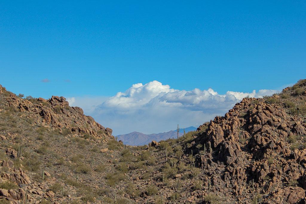
Hiking in Phoenix, Arizona is one of the best things to do in the city! Surrounded by mountains and serene desert landscapes, Phoenix hikes range from strenuous summit trails to easy waterfall walks – and everything in between.
During our many years living in the Valley of the Sun, hiking near Phoenix was our favorite weekend activity. Now, we are sharing our top trails for fellow trekkers!
Our site utilizes Affiliate Links. If you use them to make a purchase, we may earn a commission. For more information, read our Disclosure Policy.
Hiking in Phoenix, AZ

Of all the things we love best about Phoenix, hiking the various trails in the many regional parks is at the top.
You can drive in any direction and find numerous Phoenix area hikes for a fresh dose of nature and expansive views.
In this article, we begin with the best hikes in Metro Phoenix. Later, for those who want to go further afield, we share tips for the top hiking trails in Arizona.
Looking for more PHX fun? Read our guide to the Best Things To Do in Phoenix!
10 Best Phoenix Hikes
We are featuring the absolute best hikes in the Phoenix area. For each trek, we offer a description of the hike, pertinent information and trailhead location.
#1 Piestewa Peak Summit Trail
MAP. Piestewa Peak is a very popular mountain to hike in Phoenix. It was my first trek when I moved to the city – and still ranks as one of the best in Arizona.
Part of the Phoenix Mountain Preserve, Piestewa Peak stands at 2,610 feet. While it’s a top hiking trail around Phoenix, trekkers face a grueling 1.2-mile climb, with an elevation gain of 1,208 feet.
It is not an easy hike – especially when the desert temperatures soar into the triple digits. There is also no shade or water on the trail.
The reward, however, is the stunning views of surrounding mountains and the Phoenix skyline in the distance.
The trail is exclusive to hikers (no bikes, dogs or horses permitted). While some reach the summit in about 30 minutes, most take about an hour.
As one of the best hikes around Phoenix, the trail can get crowded – especially on weekend mornings.
Top Tip: Piestewa Peak Trail stays open after sunset. The official hours are from 5:00am until 7:00pm, which (depending on season) allows for a night hike in Phoenix.

#2 Quartz Ridge Trail Loop at Phoenix Mountain Park
MAP. Less frequented – and much less difficult – than Piestewa Peak is the nearby looping Trail 8A-8-304-8B combo (Route Map).
The 4.5-mile trail is rated moderate for its sloping inclines and loose rocks. Challenging, but not crushing, it’s another of our favorite trails and one of the prettiest hikes in PHX.
Popular with locals, joggers and dog walkers (which are allowed on leash), these Phoenix Mountain trails offer breathtaking desert scenery.
From the 32nd Street Parking Lot, Trail #8A ascends to a saddle and continues north to hook up with Trail #8.
Looping around to the west through giant saguaro cacti, the trail connects with #304 for a short jaunt before meeting Trail #8B.
This takes hikers back up to the saddle – and then down to the parking lot via #8A. At a good pace, this fun hike in Phoenix takes about 2 hours to complete.
Alternate Trails
There are miles and miles of trails at Phoenix Mountains Preserve (MAP). With multiple parking lots and interlinking paths, trekkers can discover many unique routes.
Hiking Phoenix Mountain Preserve in a Loop
An alternate (and easier) route is Trail 8A-8-304-Road-200-202 Loop – which is an actual loop with no backtracking.
Begin the hike the same way as above (Trail 8A), but once on the 304, instead of taking 8B, walk through the parking lot and continue to a small 3-space lot next to a ramada (on your left).
Then hop on Trail #200 and follow it until it meets up with Trail #202, which leads back to 8A and the 32nd Street Parking Lot.
Short Phoenix Mountain Hikes
Another option for shorter Phoenix hikes is Trail #202. Park at the 32nd Street Parking Lot and start on Trail #8A, but detour onto looping Trail #202 shortly after beginning the hike.
There is an upper and lower 202, which loops around the mountains just north of the neighborhood below. These trails are seldom crowded – which makes it a great hike in Phoenix for a little solitude.
Dreamy Draw
The Dreamy Draw Recreation Area provides access to Phoenix Mountain Preserve from the north. The Voaz Trail, which is accessed from the Dreamy Draw Recreation Area, is a beautiful looping route and a very scenic hiking spot in Phoenix.
Parking Tip: Our favored place to park is at the 32nd Street Lot, but it is small. Parking across Lincoln Dr. (by Starbucks) is not allowed for hikers. However, the above hikes can also be completed from the main Piestewa Peak parking area.

#3 Camelback Mountain Hike
In the shape of a sitting camel, the landmark Camelback Mountain is the tallest peak in the Phoenix Mountains.
The camel’s ‘hump’ rises to 2,704 feet – and two different Camelback trails take hikers up steep, rocky terrain and over giant boulders.
The Camelback Hike is like a rite of passage – and the first challenge is finding a parking space! Both Camelback Mountain trailheads – Echo Canyon (MAP) and Cholla (MAP) – offer limited parking, so consider taking an Uber/Lyft.
The Echo Canyon Camelback Hiking Trail is 1.2 miles each way and has an elevation gain of 1,280 feet. The Cholla Trail is slightly longer, extending 1.4 miles, with about a 1,250-foot elevation gain.
Much more difficult than Piestewa, the Camelback Mountain summit hike takes about 2-3 hours to complete, based on your fitness level. Dogs are not permitted either trail.
#4 Holbert Trail at South Mountain Park
MAP. Standing over Phoenix, South Mountain Park covers an astounding 16,283 acres of desert landscape. Even more incredible is the 58 miles of South Mountain Phoenix trails!
Of all the South Mountain hiking trails, the Holbert Trail to Dobbins Lookout ranks as our favorite. There is ample parking near the trailhead and, as always, it is best to get an early start.
The moderate trek is about 5 miles roundtrip with an elevation gain of 1,100 feet. Nearing Dobbins Lookout point, there is a detour to the overlook that provides an exceptional view over the entire valley.
Pro Tip: The Holbert Trail hooks up with the National Trail, which extends another 16 miles!

#5 Pinnacle Peak Trail
MAP. The 150-acre Pinnacle Peak Park has just one main trail, which doesn’t actually reach the summit!
Regardless, the well-maintained trail climbs up the mountainside via switchbacks through exquisite landscapes. What we love most about this hiking trail near Phoenix are the stunning vistas.
Located about 35 miles northeast of Phoenix, there’s ample parking at the trailhead (and restrooms and water fountains, too!).
The trail is restricted to pedestrian use – and is popular with joggers and rock climbers (who can access the peak with proper equipment and experience).
At 3 miles roundtrip, we rank the moderate Pinnacle Peak Hiking Trail as one of the best hikes in Scottsdale.
The highest point is 2,889 feet, which is about the half-way mark just past the Grandview Lookout. Many opt for a short hike – and just trek a half mile to Grandview, which is the highlight of the trail.
Top Tip: Looking for more hiking in Scottsdale? Tom’s Thumb and Gateway Loop (both at McDowell Sonoran Preserve) are highly rated by fellow trekkers!
#6 Waterfall Trail at White Tank Mountain
MAP. White Tank Regional Park, located west of Phoenix, boasts 30 miles of hiking trails. Although many routes are for experienced hikers, the White Tank Waterfall Trail is one of the easy hiking trails near Phoenix.
The 2-mile paved path passes by Petroglyphs, into a canyon and finally to the waterfall (which only flows after rain). The park even provides an informational guide.
In addition to hiking trails, White Tank Mountain Regional Park has numerous picnic spots with tables and grills.
Pro Tip: There is a $7 fee per vehicle to park at the White Tank Mountains.
#7 Butcher Jones Trail in Tonto National Forest
MAP. Tonto National Forest covers nearly 3 million acres of Sonoran Desert, pine forests and lakes. Featuring more than 900 miles of trails, the park is home to some of the best Arizona hikes.
The Butcher Jones Trail is our absolute favorite hike in Tonto National Forest. The out-and-back trail traverses rugged desert along Saguaro Lake and ends on the bank of the Salt River overlooking the majestic Four Peaks.
The easy-to-moderate trail extends for 2.5 miles (5 miles roundtrip) and features a few optional detours down to the water. Leashed dogs are permitted on Butcher Jones Trail.
A small recreational area and lakeside beach are situated at the trailhead. So bring a picnic and your swimsuit to enjoy the lake after your hike. You can also explore more by renting a stand-up paddleboard!
Top Tip: Visitors need to purchase and display a Tonto Daily Pass (or Discovery Pass). It must be purchased prior to arriving. We usually stop at a Circle K convenience store on the way.

#8 Hole-in-the-Rock Trail at Papago Park
MAP. Sandwiched between a golf course, the Phoenix Zoo and the Desert Botanical Gardens – Papago Park is known for its unique rock formations.
Hole-in-the-Rock Trail has long been a popular Phoenix hike. With a parking lot right at the base, it’s just a short .3-mile jaunt up steps.
This simple and easy trail leads into an opening in the sandstone butte. The cave-like geological formation was once used by the Hohokam tribe.
Although the Hole-in-the-Rock Phoenix hike attracts many to visit Papago Park, the 2.3-mile Double Butte Loop is actually more of a proper trek. The route is flat, wide and features intertwining trails that encircle two of the park’s rocky buttes.
#9 Lost Dutchman State Park
Lost Dutchman State Park features some of the most beautiful nature in Arizona and two splendid hikes.
MAP. The Treasure Loop Trail is a 2.4-mile roundtrip, dog-friendly hike that has incredible scenic desert vistas. The moderate trail is best hiked in the spring when the wildflowers are in bloom.
MAP. Siphon Draw Trail leads hikers into a canyon for a 4-mile roundtrip trek. Ambitious trekkers can continue into the Superstition Mountains via Siphon Draw up to the Flatiron for a very strenuous 5.8 hike.
Pro Tip: There is a $10 fee to enter Lost Dutchman State Park.
#10 Wind Cave Trail at Usery Mountain
Usery Mountain Regional Park encompasses 3,648 acres of desert peaks, caves and a variety of flora and fauna.
MAP. Wind Cave Trail at Usery Park in Mesa is a fun outing for the whole family. The 3-mile out-and-back hike on Pass Mountain has an elevation gain of about 800 feet (but starts at 2000 feet) – and the views are simply breathtaking.
Wind Cave, really an alcove, marks the end of the trail, but it is possible to hike past it for even more spectacular vistas.
Top Tip: There is a $7 fee to enter Usery Mountain Regional Park.

Best Hikes in Phoenix Map
Use this Google Map for an interactive version of our Best Hiking Trails in Phoenix, AZ Map below.

More Nature Hikes Near Phoenix

We shared our ten best hikes in the Phoenix Scottsdale area – and a few treks further beyond, as well. However, there are a few more trails we want to highlight for you.
Superstition Mountains

Located within the boundaries of the Tonto National Forest, the Superstitions offer some rugged and challenging treks not far from Phoenix.
Several trails start at the Peralta Trailhead (MAP) – including the popular Peralta Canyon Trail to the Freemont Saddle (which starts on Bluff Spring Trail #235).
Due to the popularity of hiking in the Superstitions, the trail gets busy and parking spots fill up quickly. Also, it’s important to note that the trailhead is located at the end of a 5-mile unpaved road.
North Mountain Park and Shaw Butte
MAP. Marking the northwest section of the Phoenix Mountains Preserve, North Mountain and Shaw Butte offers a few different trails.
The 10-mile one-way Charles M Christiansen Memorial Trail is an ambitious hike, but there are easy Phoenix treks in the area, as well.
Sonoran Preserve Trails
MAP. The trails at Sonoran Preserve range from short and easy Phoenix hikes to challenging summit treks.
Some of the best moderate hikes at Sonoran Preserve are the Apache Vista Trail, the Dixie Mountain Loop and the Great Horned Owl Trail.
Thunderbird Conservation Park
MAP. Located in Glendale to the northwest of downtown Phoenix, the Thunderbird Conservation Park boasts nearly 15 miles of trekking routes. Coach Whip Trail (a 5-mile hike) and Sunrise Trail (about 2 miles) are two of the top treks.
Arizona Hiking Trails

We have spent a fair amount of time hiking outside of Phoenix – and have discovered a few of the best hikes in Arizona along the way!
Hiking in Sedona

Sedona, known as Red Rock Country for the region’s vibrant sandstone formations, is a beautiful place to hike in Arizona!
Among the many Sedona hiking trails, Cathedral Rock is the most gorgeous. Other popular Sedona hikes include Devil’s Bridge and Bell Rock. You can harness the positive energy in the area by joining a Sunset Vortex Tour!
Flagstaff Hikes

We love visiting Flagstaff for many reasons – and the cooler summer temperatures and incredible nature are on the top of that list!
As the highest point in Arizona – rising to 12,633 feet – hiking on Humphrey’s Peak is amazing. However, with an elevation gain of 3,000 feet, only experienced hikers should attempt the 10.5-mile hike.
We take the Snowbowl Gondola up and explore on foot once on the summit. Read more about the Best Things To Do in Flagstaff during the summertime!
Tucson Hiking
Sabino Canyon in the Coronado National Forest is regularly ranked as one of the best places to go hiking in Tucson.
While we will not argue that fact, our favored place to hike near Tucson is Saguaro National Park, which features trails through the largest cacti in the country.
Payson Hikes
There are plenty of wonderful hikes in Payson, Arizona – but none are as awesome as the Fossil Creek Bob Bear Trail (formerly called Fossil Spring Trail).
The difficult trail descends 1,500 feet to a stream bed, waterfalls and swimming holes. The out-and-back trek is about 8.5 miles roundtrip. Remember, you need to climb up to get out!
Hiking Antelope Canyon

Probably the most famous and photographed Arizona hike, Antelope Canyon is comprised of an Upper and Lower section.
The canyon is located in Navajo Tribal Park – and can only be explored with an official Navajo tour guide. Book your tickets in advance for the Lower Canyon and the Upper Canyon.
Hike to Havasupai, AZ

The trail to Havasu Falls is one of the best hikes in AZ! That said, reservations or a camping permit are required for this Arizona hiking trip – as day hikes are no longer permitted.
Grand Canyon Arizona Hiking

Many of the top hiking trails in Arizona are at the landmark Grand Canyon. The most difficult is the 21-mile Rim to Rim hike.
Rather than tackling this 15-hour hike in one day, trekkers can stay at Phantom Ranch or in a tent in the bottom of the canyon.
We have yet to complete the Rim to Rim trail, but have ventured down into the canyon on several day hikes. In our opinion, the Angel Bright Trail is the best choice!

Tips Before Hitting the Trails on Phoenix Hikes

Now that you know the where to go hiking in Phoenix (and elsewhere in Arizona), we have a few final tips before you start your trek!
Pack Plenty of Water
Phoenix earned its nickname, The Valley of the Sun, for good reason. The sun is intense in the Arizona desert – and it is easy to become dehydrated.
Anyone who hikes Phoenix trails needs to bring plenty of water. We recommend wearing a hydration system or carrying collapsible water bottles for your trek.
Arizona Sun Protection
Don’t forget to slather on the sunscreen before you set off on your AZ hike – and bring it along with you!
We also suggest wearing sunglasses and a wide-brimmed hat to keep the sun off your face. A bandana can come in handy to protect your neck from the sun’s rays, too!
Durable Shoes
In our opinion, most of the places we feature don’t require hiking boots. For the trails near Phoenix that we highlight, we wore Merrell Trail Shoes or Everyday Trainers.
Hiking Poles & Backpack
While hiking poles are not necessary, they are certainly helpful – especially when tackling some of the summit trails in Arizona.
We like these collapsible poles, which can be carried in our backpack when we don’t need them!
Best Time for Phoenix, Arizona Hiking
In the summertime, getting an early start on day hikes near Phoenix is essential. Do not attempt to hike in the heat of the day!
Hiking Tours Phoenix
If you are new to the city, a solo traveler or just want an introduction to the scenic hikes near Phoenix, consider joining a private Phoenix Hiking Tour.
On a half-day excursion, an experienced guide will take you to the prime hiking places and explain the flora and fauna as well as facts about Arizona along the way.

Start planning your US trip! Search for the lowest airfares, the best accommodations and fun things to do…then start packing! Want more advice? Head over to our Travel Planning Page and for country-specific information, take a look at our Travel Guides Page!
More Great Outdoor Destinations in the USA
Checkout our recommended places to Hike at Glacier National Park, Along the Oregon Coast and near Columbus, Ohio (including Hocking Hills).
We also have complete guides to Montana, Oregon and California. Plus, itineraries for long weekends in Seattle, Portland, Denver, Austin, Malibu and San Diego!
Get inspired for your next USA Weekend Getaway – plus our favorite Underrated US Destinations!

Pin it! See all of our travel pins on our JetSetting Fools Pinterest Board.
